|
| ||||||

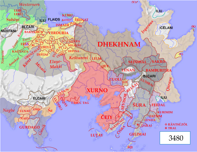
The Caďinorian PlainThe map shows the eastern half of Ereláe, with terrain features and political boundaries.
Dhekhnam: The empire of the ktuvoks
Xurno: A land ruled by artists
Tžuro: Heirs of Attafei
Years on this website are expressed in ZE (zonî erei, 'years of the South')-- years since the founding of Ctesifon, modern Žésifo, capital of the ancient Caďinorian Empire. The current year is ZE 3480.
Why south, when the Caďinorian plain is on the north of the continent? Not, as you might think, because it's in the southern hemisphere. It dates back to early Caďinorian times, when the Caďinorians thought of themselves as occupying the southern quadrant of the known world. The Cuzeians had the west, the Meťaiun the north, and the Munkhâshi had the east.
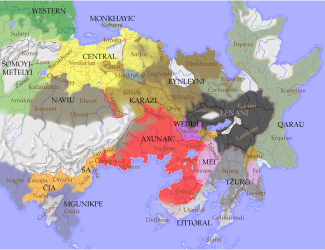
The map below shows the human language families; uninhabited areas, and regions populated by non-human lesüasi are shown in white.

Of course, on a map of this scale it isn't possible to show individual languages, much less such things as multilingual regions, or cities which speak a different language from their surrounding countryside.