
The Planet Construction Kit is printed in black and white, which makes the climate maps a little hard to grasp. So here they are in color.
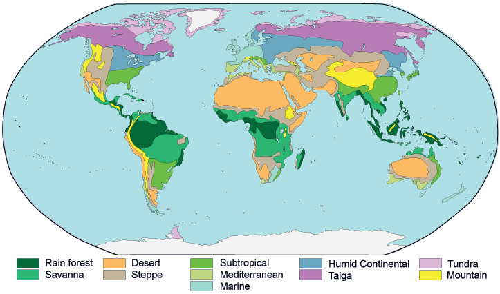
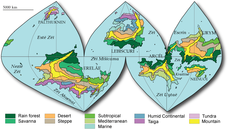
For simplicity's sake I combined the cold and hot deserts on the map (the cold deserts are in the temperate zone) and the rain forest and monsoon areas (the latter depend more on wind direction and continental placement anyway).
For location, Earth's Hadley cell is presently 0 to 30 degrees, the Ferrel cell 30 to 60, the polar cell 60 to 90. EQW = equatorward, PW = poleward. These are very rough guidelines!
| Type | Code | Temp | Rainfall | Typical flora | Where to put it |
| Tropical | |||||
| Rain forest | Af | 27 C | heavy all year | very dense forest | EQW half of Hadley |
| Monsoon | Am | 20 - 27 | long wet season | dense forest | Continental areas off equatorial seas |
| Savanna | Aw | 24 - 28 | short wet season | scrub | PW of rain forest |
| Dry | |||||
| Desert | Bwh | 13 - 35 | almost none | cactus, shrubs | PW side of Hadley on E side of continents |
| Cold desert | Bwk | -6 - 28 | almost none | temperate zone with mountains to W or S | |
| Steppe | Bs | 2 - 25 | minimal | grassland | between deserts and other areas |
| Subtropical | |||||
| Subtropical | Cfa | 10 - 26 | all seasons none | deciduous forest | EQW half of Ferrel on E side of continents |
| Mediterranean | Cs | 11 - 25 | wet winters | forest or shrubs | EQW half of Ferrel on W side of continents |
| Marine | Cfb | 6 - 18 | wet summers | deciduous forest | PW half of Ferrel on W side of continents |
| Continental | |||||
| Humid | Da/b | -4 - 24 | all seasons | forest, prairie | PW half of Ferrel in large continents |
| Taiga | Dc | -20 - 18 | low | conifer forest | PW of Humid in large continents |
| Arctic | |||||
| Tundra | ET | -28 - 12 | minimal | no trees; permafrost | PW rim of continents |
| Ice caps | EF | -80 - 15 | almost none | almost none | polar oceans and interior of polar islands |
| Misc | |||||
| Mountain | generally arid | varied | high mountains - complex climate |